NASA-ISRO’s NISAR Satellite Set for July Launch: A Major Leap in Earth Observation
NASA and ISRO are preparing to launch NISAR, a high-tech satellite designed to study changes on Earth in extraordinary detail. The $1.5 billion satellite will lift off in July 2025 aboard India’s GSLV Mark II rocket from the Satish Dhawan Space Centre. Once in orbit, NISAR will provide critical insights into natural disasters, climate change, and environmental changes worldwide.
What is NISAR?
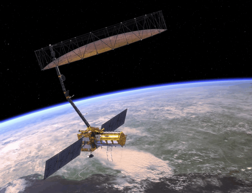
NISAR stands for NASA-ISRO Synthetic Aperture Radar. It is a special satellite because it is the world’s first Earth-observing satellite to use dual-frequency radar technology. This means it uses L-band and S-band synthetic aperture radar (SAR) waves to scan the planet. Unlike regular optical satellites, NISAR can see through clouds, smoke, and even thick forests. This ability makes it a powerful tool to monitor Earth under all weather conditions, day and night.
The satellite will weigh nearly three tonnes and orbit Earth every 12 days, creating high-resolution maps of changes on the planet. These detailed images will help scientists understand earthquakes, floods, landslides, soil moisture, glacier melt, and agricultural patterns.
Why is NISAR Important?
Every year, natural disasters like earthquakes, floods, and landslides cause damage worldwide. Many of these disasters happen suddenly, leaving little time for preparation. NISAR’s ability to track ground movement down to a few millimeters could help scientists predict potential disasters before they happen. By monitoring tectonic plate movements, NISAR can provide early warnings for earthquakes. Its radar can also detect water levels, making it useful in flood prediction.
Another major function of NISAR is climate change tracking. The satellite will measure glacier melt rates, deforestation, and ocean changes, helping scientists understand how the planet is changing over time. It can also monitor groundwater levels, which is crucial for regions facing water shortages.
In addition, NISAR will track forest biomass, which means it will help scientists study how much carbon is stored in trees. This data is important for climate researchers studying global warming.
A Decade of Collaboration
NISAR is a joint mission between NASA and ISRO, which means engineers from both space agencies have worked together to design, test, and build this satellite. The collaboration started over a decade ago, with NASA’s Jet Propulsion Laboratory (JPL) and ISRO’s Space Applications Centre leading the development.
The final assembly and testing were completed at ISRO’s Bengaluru facility, where engineers carefully integrated NASA’s radar systems with ISRO’s satellite framework. After successful tests, the satellite was transported to its launch site in Sriharikota, India, where it now awaits its grand launch in July.
Who Can Use NISAR’s Data?
One of NISAR’s biggest advantages is its open data policy. This means that scientists, government agencies, and research institutions from around the world can freely access its data. Unlike some satellites that restrict data use, NISAR’s high-resolution images will be available to universities, disaster response teams, environmental groups, and policymakers.
For example, if a flood or earthquake happens, emergency response teams can use NISAR’s data to assess damage and plan rescue operations. Farmers can use the satellite’s information to study soil moisture levels and improve crop production.
Looking Ahead
NISAR is a groundbreaking satellite that will change how we study Earth. Its ability to provide accurate, real-time monitoring of environmental changes will be valuable for scientists, governments, and communities worldwide.
As NASA and ISRO prepare for this historic launch, the global scientific community is eager to see how this technology will improve disaster prediction, climate monitoring, and resource management. With more than ten years of engineering and collaboration, NISAR is ready to take flight and provide insights that could help protect our planet for generations to come.